3D brings on a completely different dimension to researching those locations where we hope to find some signs of wildlife, especially those we have tags in our pockets for. Some of you may be first-time hunters, while others are seasoned and full of knowledge. We know that our mapping platform will help both groups achieve a desirable outcome this season. We have already seen it over the past year.
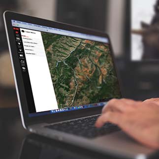
One of the most important mapping layers we have is the Government Land Ownership. Everyone needs to know where they are and what areas may be off limits. This layer helps define those boundaries within a map. Other common useful layers are our topographic maps and aerial imagery. For years, the USGS has updated and produced very high quality and rich in data topographic maps. We provide this layer as a basemap/overlay. We also provide every western state hunting boundary, which is for multiple species and filterable. Most of our layers are filterable, and you can change the opacity. This feature allows you to only see what data pertains to your research.
Other Helpful Features:
· Save a map area
· Create, manage, and share waypoints
· Create, manage, and share paths
· Hundreds of supporting data layers
· Measure distance and area in 3D
· Find your location on a map
While other companies provide similar tools, our map has been built and tailored to hunters. It was built by hunters for hunters. Feel free to reach out to us if you have any suggestions or enhancements. As always, happy mapping!
