For months now, we have been trying to push 2020 out the door and are ready to welcome 2021. Not only because of the pandemic and other things, but also because we have been working hard to bring our members an update to the 3D Mapping Platform. We have made a ton of progress and enhancements and want to share them with you.
User interface and experience was one of the leading factors to most of these changes. Don’t worry, we haven’t moved or deleted any of the map layers or 3D interface. We have increased the size of buttons on the map and created a consistent theme throughout the application. Here is a more detailed list of what we have accomplished:
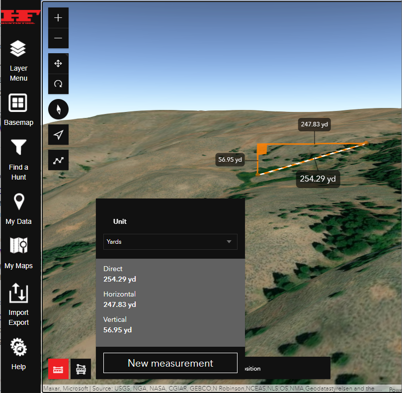
Line Measurement Tool
This tool, found on the bottom left of the map window, allows you to measure in 3D. The measurement is defaulted to yards, but you can change that to different measurement units. it also displays a drop or rise along your measured line.
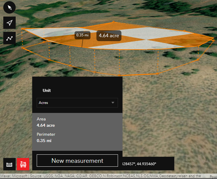
Area Measurement Tool
This tool allows you to find area measurements. It is similar to the line measurement tool in respect to adding the measurement to the map. I find both of these tools to be useful in many ways. The default measurement unit yards, but you can change that.
Add a Line or Path to Your Data Management System
Draw, manage, and store a line/path on the map. This feature allows you to save a path to your data management system. It stores the data just like your waypoints, in folders. Share among other Huntin’ Fool members or export to a kml. This feature was a huge improvement to our data management system. You can change the width and color of the line, along with displaying the distance of your line. It will also give you a measurement of the path you just drew on the map.
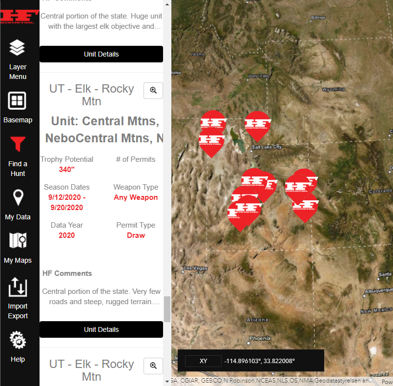
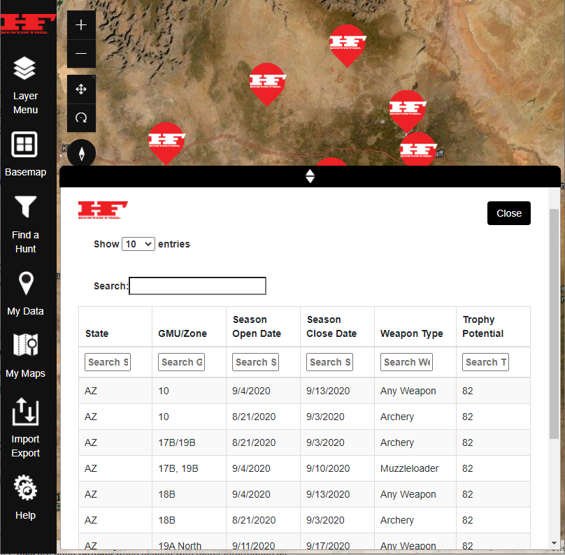
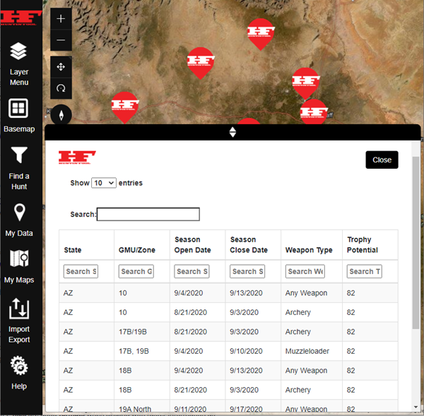
Find Hunt Data Filters, Table, and Results Update
This tool is a huge asset to our 3D Map. We are the only outfit providing custom, detailed, and proprietary hunt data all in one mapping platform. This hunt data is what you will find in our magazines. However, this tool will let you filter the data and customize what you are searching for. After setting up the filter, you can view your results in a heads-up list or filter it down more within a table format. Like I mentioned earlier, this is a huge benefit to eScouters trying to research and find potential new hunting units on their own.
Import and Export KML Files
We never want to limit our users to only using or working with one mapping platform. Limiting this hinders not only the user, but us as well. We implemented this tool so that our 3D Mapping Platform and our Data Management System can play nicely with other platforms.
Cursor Location and Display Lat/Long Tool
Located at the bottom of the map window, this tool shows you where your cursor is located on the map. It displays a latitude and longitude and gives you measurement units. UTM, DMS, DD, and XY are just a few unit types you can choose from.
This is just a handful of our enhancements. We will continue to make this mapping platform the best and most complete. We have a list of things we will be working on next year, but we will be keeping those ideas and initiatives close to us. However, we are super excited with the direction our 3D Map is going.
Our goal all along was to build a platform that empowered our users. Provide the tools, data, and data management system to fill the needs in this industry. That is our motto and will continue to be. We appreciate your use of our 3D Mapping Platform and encourage you to start planning for your next hunts
We will be working with our marketing team to add more “Mapping Minutes” to our YouTube channel with these new updates. Follow us on Instagram and Facebook to stay updated with the latest news.