When boots on the ground is not an option for scouting, we utilize online resources to help fill the need. We are seeing a number of 3D mapping applications hit the market for hunting and outdoor purposes. That’s great and all, but finding the right one can be daunting. Huntin’ Fool’s very own 3D Hunt Planner has tools built in to help all levels of e-scouting. With the launch of Version 2 last month, we added several different tools and enhancements, including the Line of Sight measuring tool.
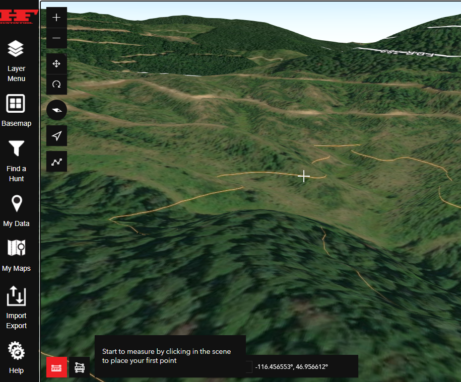
The Line of Sight tool is packed with a ton of user choices. While the 3D surface enhances our efforts, we want you to dive into locations and use our Line of Sight tool to really understand the terrain. This tool is located at the bottom left-hand corner of the map window. Simply click on it to activate the tool. Once activated, you can pan through the map and notice that it shows contour lines in a faded orange color. This is useful because it will snap to contours in the map.
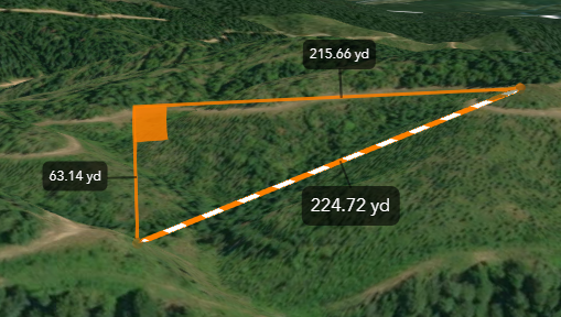
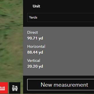
The Line of Sight tool is 3D enabled, allowing you to measure “as the crow flies” and “slope distances” along the surface. I use this tool to help me understand what my drop-in elevation is over a certain distance. I also use it to see if I can see over a ridge or peak. This tool shows you if your glassing spot is suitable for the distance you are wanting to scout. For instance, the tool will grey out in areas that go through the 3D surface, letting me know that I cannot see over a certain peak or ridge.
You can also change the units of measurement. I have configured this tool to default to yards, but you can choose from several different units of measurement. I encourage you to try the new measurement tool out. Familiarize yourself with it. You may not know when it will become a valuable tool for you.
We hope you enjoy Version 2 of our 3D Hunt Planner. As always, check out our YouTube series on using the application. Happing mapping!