Making the right preparations for an upcoming hunt is half the battle. After the tag has been drawn, the research begins. Throughout the years that Huntin’ Fool has been around, we’ve marketed our brand as being able to help our members from the application process all the way to the harvest and beyond. We have a vast amount of resources to help you after you’ve drawn a tag, but our newest resource is going to be a game changer. We are providing our members with the most powerful mapping platform ever – the 3D Map.
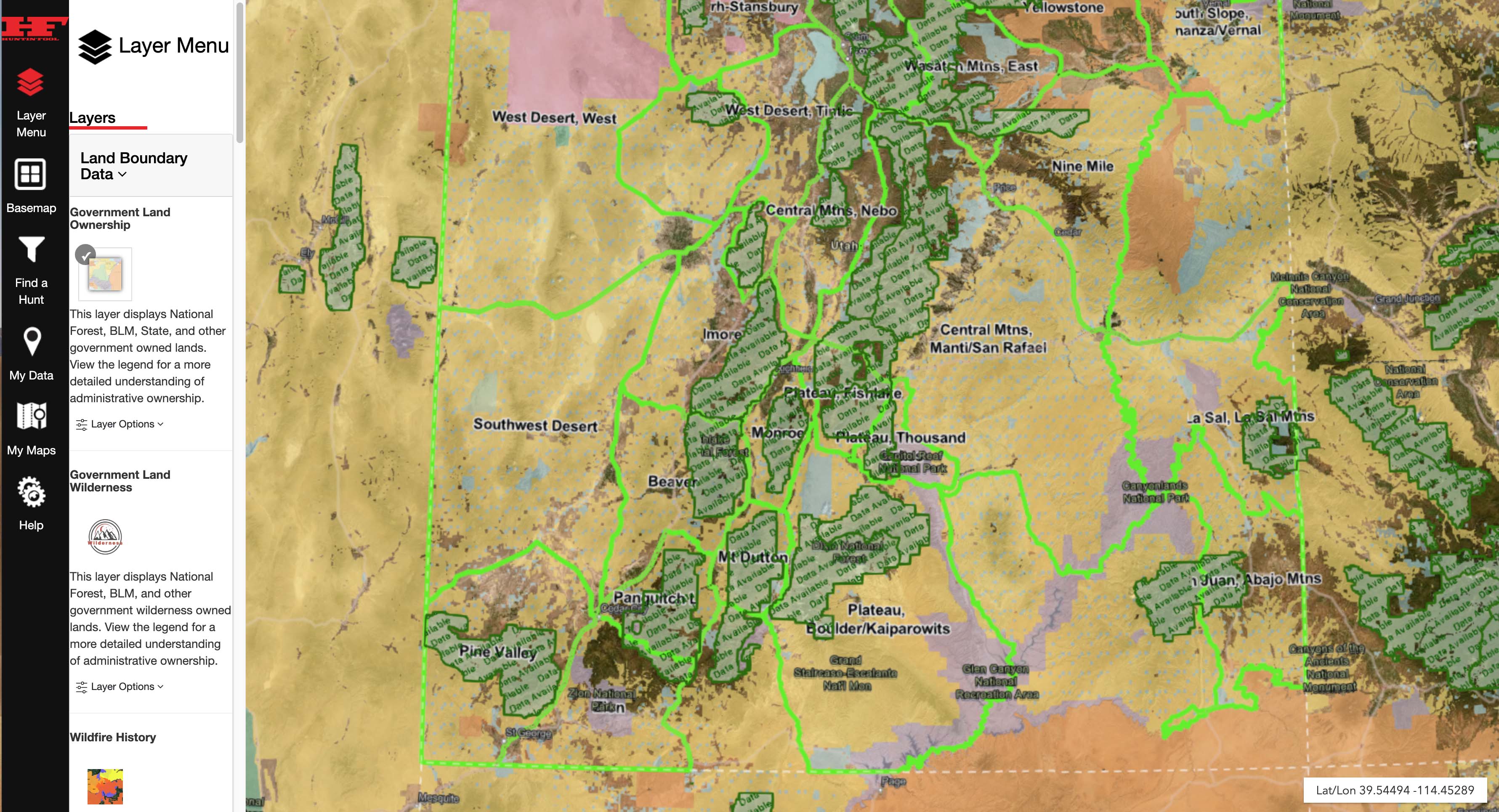
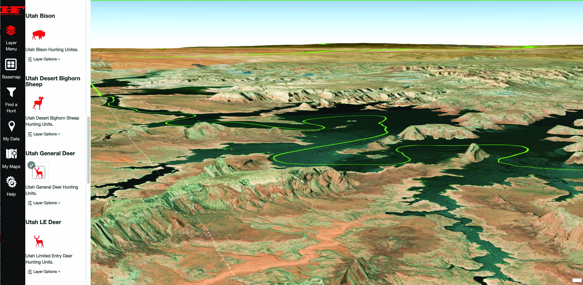
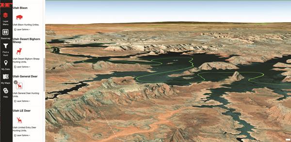
Knowing the lay of the land you’re about to enter gives you a major leg up in working towards a successful hunt. To access the 3D Map, go to www.huntinfool.com/mapping. Click launch the 3D It will bring up a satellite map, which you can then customize to fit what you are looking for. Choose from the “Layer Menu” whether you want it to show Land Boundary Data, Roads & Trails, Items of Interest, Water Data, Weather Data, and/or Hunting Data. From the Hunting Data menu, you can select specific state, species, and unit information to be highlighted on the map. It takes the guesswork out of trying to figure out what exactly you’re looking at when researching the terrain and data information about specific units. You can also select your “Basemap.” The options include a USA Topo, World Topo, USGS Topo, and USGS Imagery Hybrid. The options to customize the maps are vast.
When you’re ready to look at specific hunts, there is an option for that on the main menu. Click “Find a Hunt” and a list will pop up. The filters will help you narrow down exactly what units fit the criteria you’re looking for. You can filter and search by species, gender, weapon, trophy potential, and state. From here, you can search through the results, comparing units and finding which one is the right fit for your hunting goals. The information you find here is the same information found in the state sections in our magazine. Instead of having to flip back and forth between your computer and the printed magazine, you’re able to see the information within the mapping platform while you study and compare units and their topography.
Our staff has been working tirelessly to input the statistics from our state sections in the magazine into this mapping platform. That way, you can select a unit that you’re interested in on the map and see the latest data trends for draw odds, harvest statistics, and more. You’ll find your Huntin’ Fool membership experience to be that much more interactive with this new tool. Instead of having to look in multiple places for unit information, you’ll find it on this map with a few simple clicks of a mouse. It makes your research more efficient, leaving more time for you to focus on other aspects of the application and hunting season.
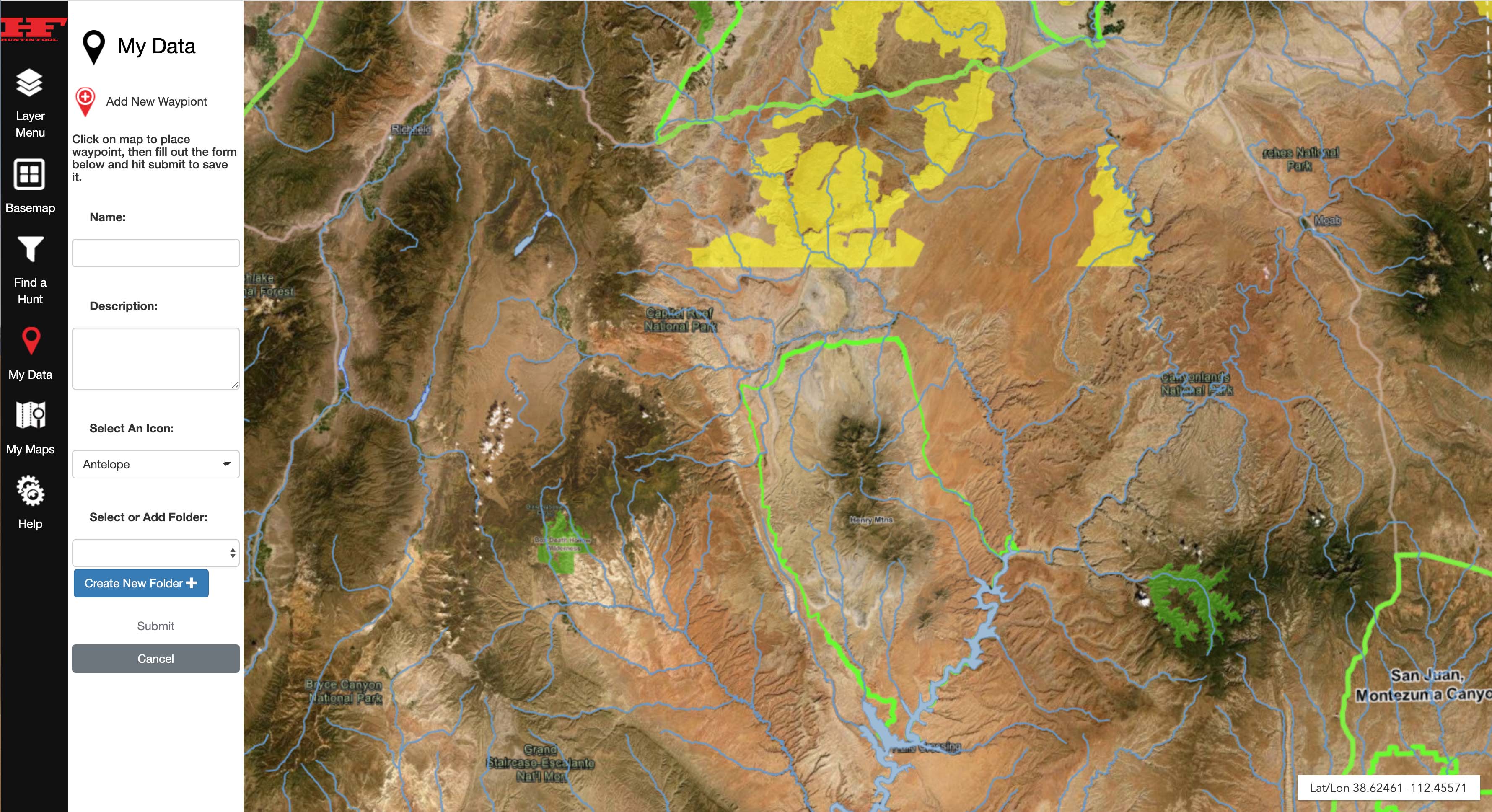
The “My Data” and “My Maps” menu options allow you to save the information that’s pertinent to you. You can add as many maps as you’d like, saving information for different units and/or different upcoming hunts. There’s no need to start over the next time you pull up the mapping tool. Everything you’ve customized on your map will be stored for you within your Huntin’ Fool login.
To ensure we are providing you with the best mapping platform around, the state data in the hunt filter tool will populate in real-time in conjunction with our magazine publishing schedule. For example, the Nevada data will be available after our April magazine goes to press. That way, you’re receiving the most up-to-date information about the units you are researching.
The 3D Map is still in development and will continue to be as we move forward. You will see weekly updates and improvements to the platform. The customization will only get better, and it will be your one-stop shop for application to harvest information. As with all technology, though, we’re aware that there may be times that the platform glitches or presents challenges to its users. That being said, we want to know about these. Your feedback is vital to the improvements and betterment of this 3D Map. We welcome any and all comments, compliments or critiques, at feedback@huntinfool.com.
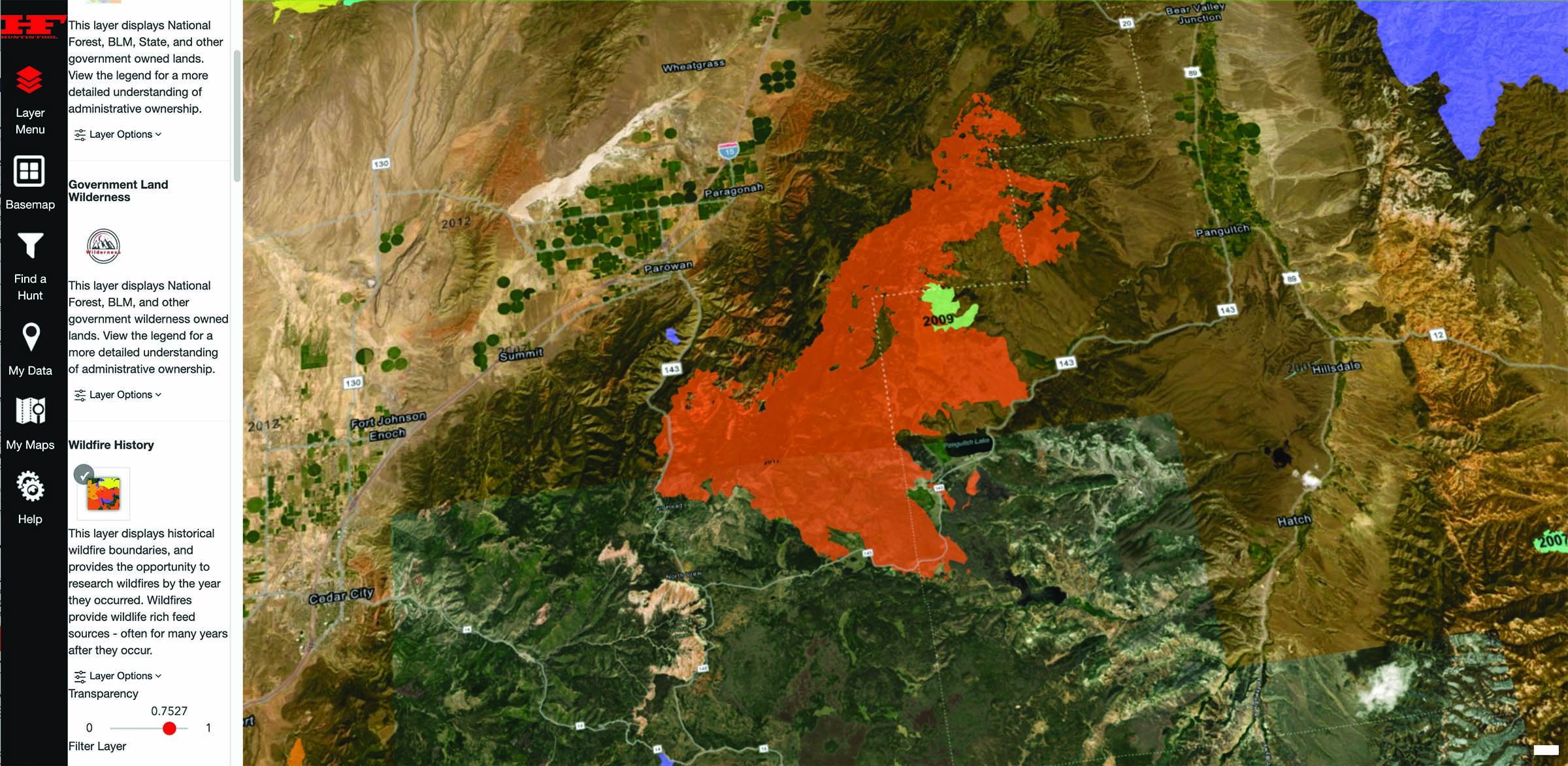
This resource is nothing like you’ve ever seen before from Huntin’ Fool. It shows you information on 3D landownership, wildlife history, current weather, state GMU boundaries, and harvest statistics. You can use a HuntFinder filter to find your perfect hunt, combining our ever-popular hunt finding resource with this new tool. This is the most powerful hunt planning tool out there, and as a Huntin’ Fool member, you have all of the information right at your fingertips. Give it a try, and let us know how it helps improve your hunting research.
Try out the new hunt planning platform today at www.huntinfool.com/mapping.